
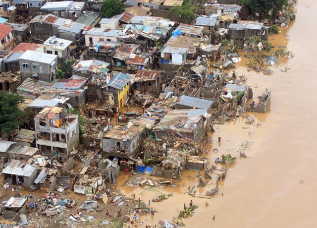
In the past month we have seen Mexico hit by Hurricane Ingrid, India battered by Cyclone Phailin and destruction in Japan from Typhoon Wipha.
It would be easy to then assume that each of these devastating storms represent different types of extreme weather.
In fact they are all descriptions of the same meteorological phenomenon – a rotating mass of air that centres around an area of low pressure, bringing high speed winds, heavy rain and thunder storms.
Hurricanes generally form in the north Atlantic ocean or in the north east Pacific Ocean, with the Caribbean sea being worst effected.
Typhoons develop in the north western part of the Pacific Ocean, affecting south east Asia, the South China Sea and Japan most.
They are both types tropical cyclone, which form over large bodies of relatively warm water in the tropics.
Generally speaking a cyclone is a spiralling body of air and once they reach a certain size and intensity they become designated as hurricanes or typhoons.
Their energy comes from the evaporation of water from the ocean surface that forms clouds high in the atmosphere.
The combination of warm sea surface temperatures, atmospheric instability, high humidity in the troposphere and the Coriolis effect to produce a low pressure centre combine to form such tropical cyclones.
The circulation of warm moist air takes on a circular motion due to the Earth's rotation, rotating clockwise is the Southern hemisphere and anti-clockwise in the northern hemisphere.
Eventually this builds until it forms a characteristic cyclone, which when viewed from above looks like a spiral of cloud around a central "eye".
Tropical cyclones typically can stretch several hundred miles in diameter but have been known to be more than 2,500 miles across.
Towards the centre of the storm the strongest thunderstorms and winds circulate while the relatively small cloud free eye is comparatively calm.
They generally have winds that are at least 74 miles per hour but some of the strongest have winds that are sustained around 195 miles per hours.
Hurricanes are classified on the Saffir-Simpson Hurricane Wind Scale that classifies wind speed and damage intensity, with one being the weakest and five the most powerful. In 2005 there were four category four hurricanes, including Hurricane Katrina.
Typhoons are also rated on the Saffir-Simpson scale but the Japan Meteorological Agency also uses its own Typhoon scale.
In general there are around 10-15 hurricanes a year while there are up to 30 typhoons a year.
This is because there is no official typhoon season as tropical cyclones form through out the year in the north western Pacific, with June and November being the most intense period.
Hurricanes generally form between June and November. Hurricanes that cross into the western Pacific even become re-designated as typhoons.
The western North Pacific basin has the most intense tropical cyclone activity of any basin.
In 2012, the region saw a busy tropical cyclone season, with 25 events which reached Tropical Storm intensity or higher, according to World Meteorological Organisation.
Tropical storms are named using a standard method laid out by the WMO. Each ocean basin is designated a list of hurricane names for six years.
These names are put forward by the Tropical Cyclone Regional Body for that ocean basin at its annual meeting. There are five of these bodies.
Hurricanes are named using a rotating list of male and female names.
This started with feminine names in the mid 1900s when the mast of a boat named Antje was ripped off by a storm and it became known as Antje's hurricane.
Meteorologists began identifying storms using names from an alphabetically arranged list so the first storm to occur in a year would begin with an A.
By the end of the 1900s forecasters also started using male names for storms forming in the Southern Hemisphere. Now alternating male and female names are used.
Six lists of names are used in rotation in both the North Atlantic and in the north east Pacific.
The names for typhoons are also selected from a list but these are far more complicated.
A set of 140 names are selected by countries that sit around the basin and include names of people, types of animal, plant, words from astrology, places and mythological figures.
They are not alphabetically ordered and are assigned by the Tokyo Typhoon Centre, but they will work sequentially through the list.
According to the list the latest typhoon to emerge has been named Francisco and the next will be called Lekima.
Similarly storms in the Indian Ocean, near Australia, near Fiji, Papau New Guinea and Indonesia all have their own lists of names that are used.
When a storm is deemed to be particularly deadly or costly, its name is deemed to be inappropriate for future use and it is stricken from the list. Another name is selected to replace it.
Infamous storms such as Katrina, Mitch and Tracy are all examples of this.
Friday 18 October 2013
http://www.telegraph.co.uk/topics/weather/10385681/How-do-you-tell-the-difference-between-a-cyclone-a-hurricane-and-a-typhoon.html


0 comments:
Post a Comment